Nueva Italia - Puerto Breu Roadway: Illegal mining, clandestine airstrips, and illicit crops in the UC-105 sector
Pucallpa, 8th of December 2025. Recent satellite detections have cautioned towards an increase in deforestation associated with illegal mining, the construction of clandestine airstrips, and the expansion of illicit crops along the illegal UC-105 roadway, which aims to connect Nueva Italia with Puerto Breu, in the district of Yurúa (Ucayali).
At the end of November, the “Sawawo Hito 40” indigenous community documented the opening of an access road, alongside new deforestation activity within their territory, located 2.4 km from the Alto Tamaya Saweto community and 3.7 km from the border with Brazil and the Apiwtxa community.


Recent deforestation in Sawawo Hito 40, 2.4 km from Alto Tamaya Saweto and 3.7 km from the border with Brazil
Between August and November 2025, a spike in illegal activities was recorded. Satellite image analysis and field verifications identified new areas of deforestation, active mining operations, and the opening of airstrips allegedly linked to drug trafficking rings.
Animated map showing the expansion of deforestation and new invasions along the UC-105 sector between 2023 and 2025
The native communities reported on territory-specific impacts. In Sawawo, invasions and the presence of third parties linked to illegal mining activities and the opening of new access roads were documented. In Alto Tamaya Saweto, the removal of boundary markers on its southern border was confirmed, further exacerbating a historical risk for the community since the assassination of four Asháninka leaders in 2014.
The Yurúa/Juruá/Alto Tamaya Transboundary Commission, which brings together leaders and authorities from 28 territories and 13 ethnic groups from Peru and Brazil, recalled that since 2020, it had issued public alerts about the impending risks that would result from the opening of the UC-105 —a road that lacks any environmental study or prior consultation— which facilitates the entry of illicit activities into areas of great biodiversity and indigenous territories, including those in isolation and initial contact.
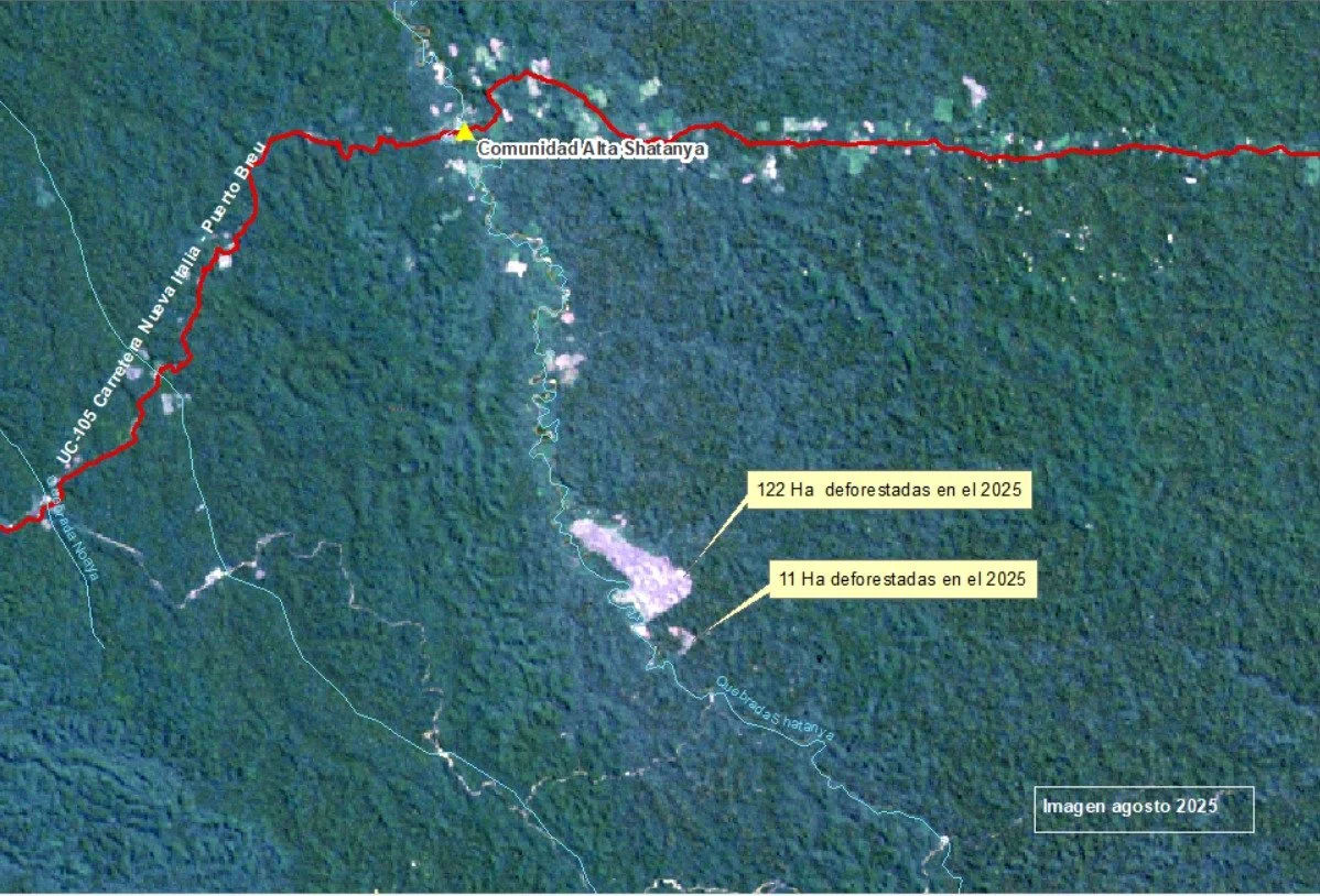
Satellite image showing recently deforested areas (122 ha and 11 ha in 2025) in the vicinity of the Alta Shatanya community, linked to the expansion of illicit activities associated with the illegal UC-105 roadway.
Maps, aerial photographs, and satellite images, displayed in this report, show the location of recent deforestation plots, the areas affected by illegal mining, and the layout of clandestine airstrips operating within the UC-105 sector.
The Transboundary Commission, of which Upper Amazon Conservation (UAC) is a strategic member in Peru, reiterated its request to the Regional Government of Ucayali and the central government to implement urgent control measures, surveillance, and sanctions against the advancement of these activities in the area.
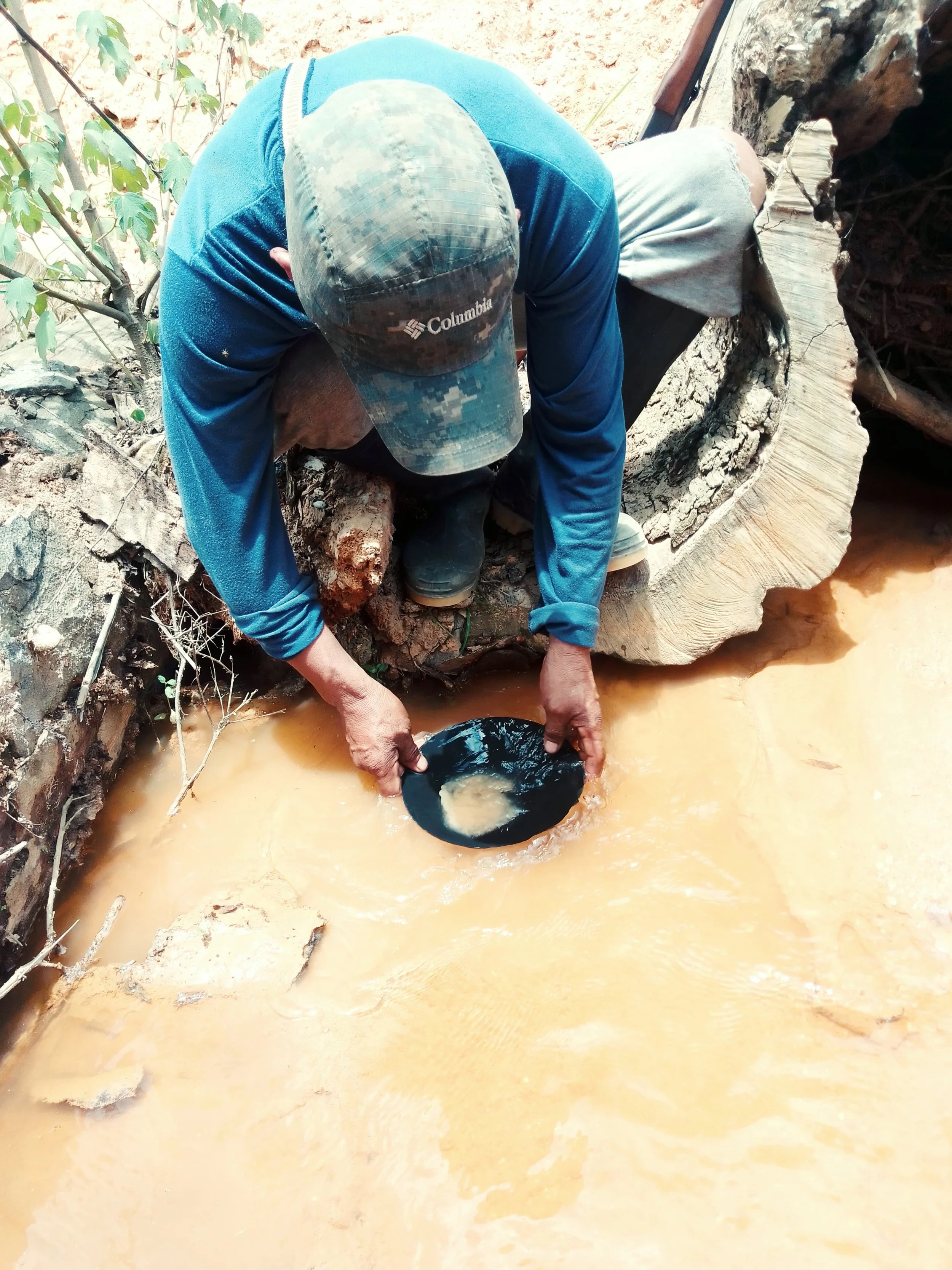
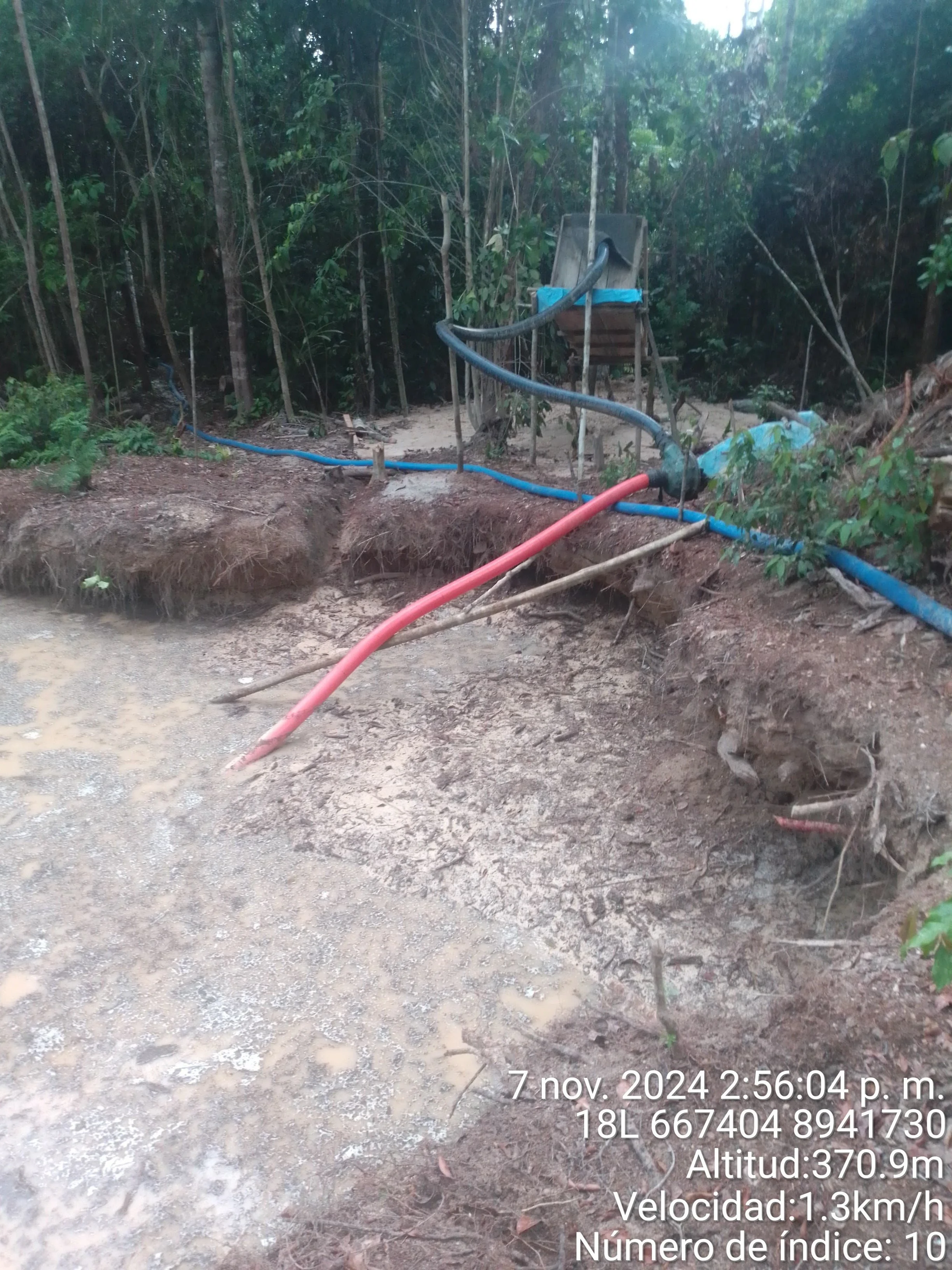
Images that show recent illegal mining operations associated with the activation of the UC-105 roadway
The UC-105 roadway, which is still underway, has become a key entry point for illegal activities in the region. What was for years a warning is now confirmed as a documented risk to indigenous territories and the border communities.
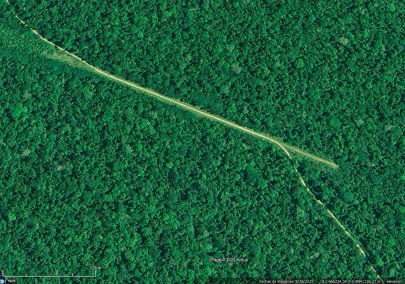
900m airstrip camouflaged by an adjacent road to the UC-105 roadway