Restoring Boundary Markers for the Saweto Community Highlights Challenges to Territorial Protection
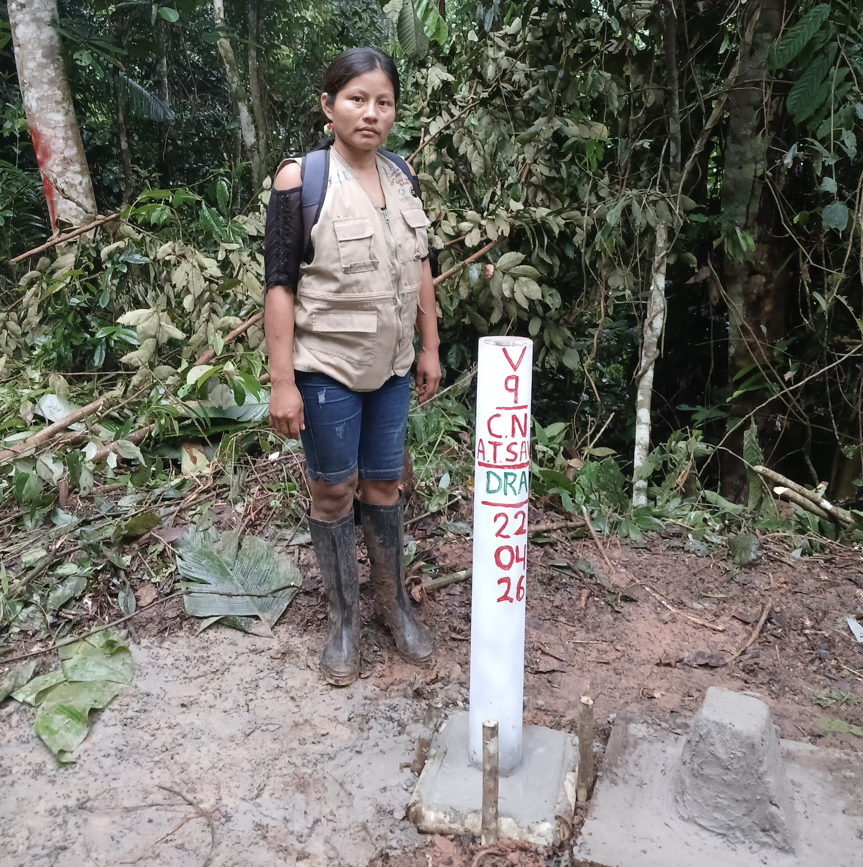
Stefania Arévalo Cushamba, president of the Alto Tamaya–Saweto vigilance committee, standing beside a boundary marker replaced during the territorial verification process.
April 2026
Along the southern boundary of the Alto Tamaya–Saweto Native Community, located in the Ucayali region along the Peru–Brazil border, community members and technicians traveled for several days through rivers and forest to locate, verify, and replace key territorial markers defining the community’s boundaries.
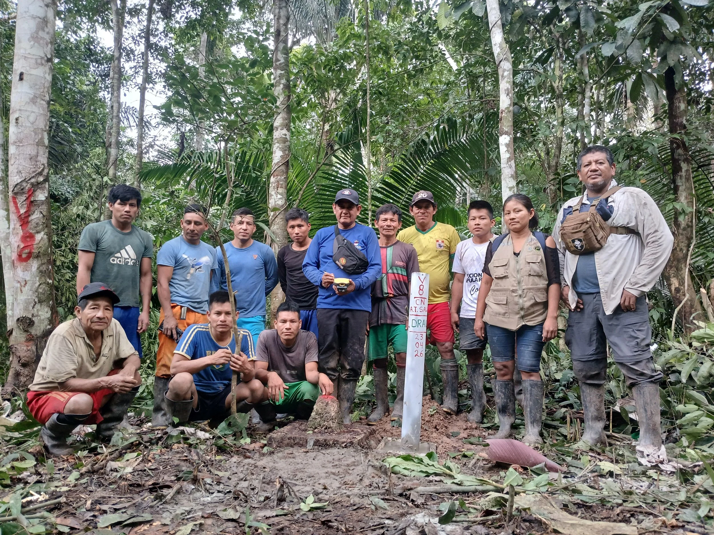
Between April 16 and 26, 2026, a technical team composed of community members, Upper Amazon Conservancy (UAC) staff, and representatives from Ucayali’s Regional Agriculture Agency (DRAU)- the government entity responsible for Indigenous community titling- carried out the verification and replacement of five community boundary markers.
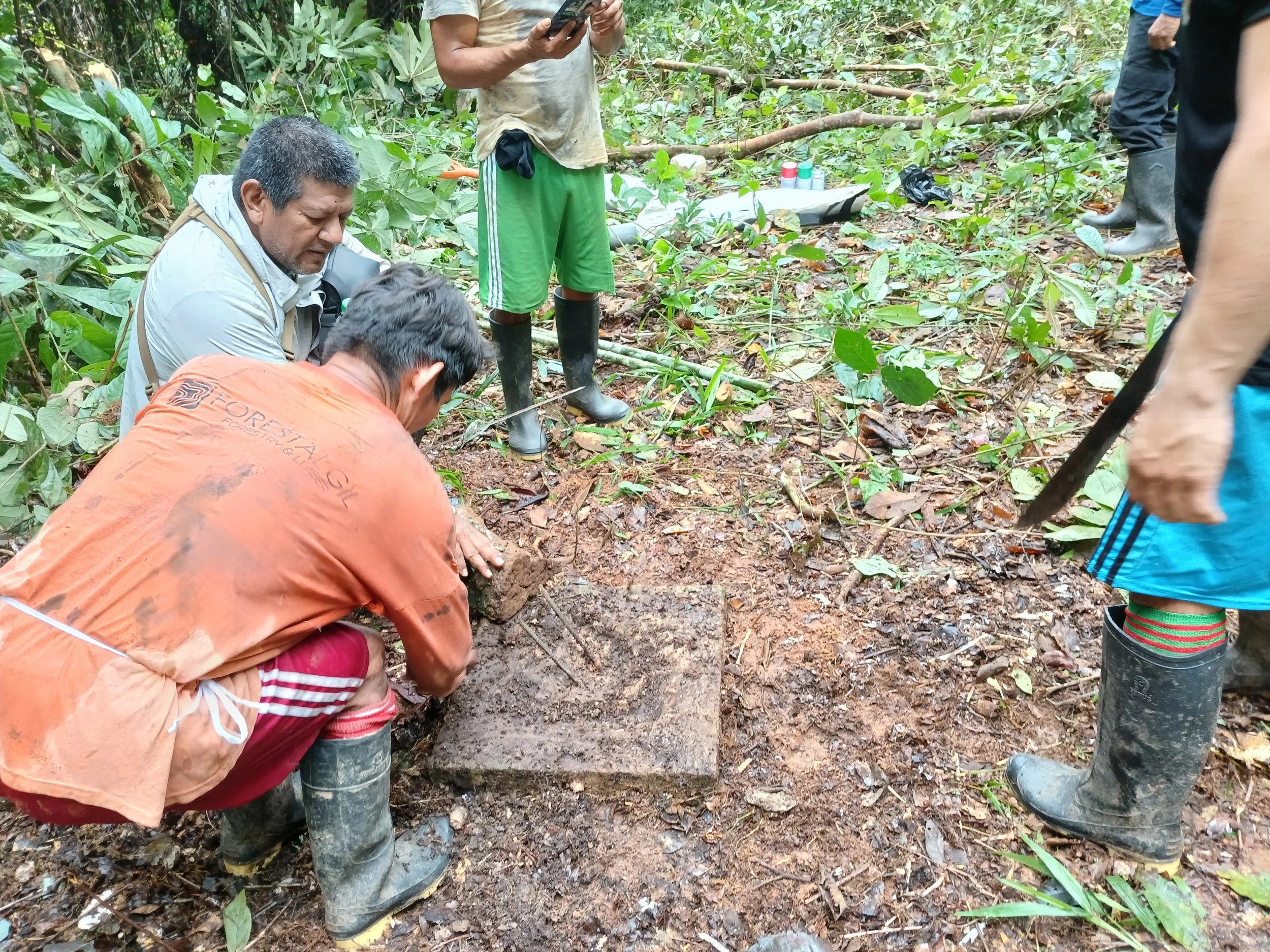
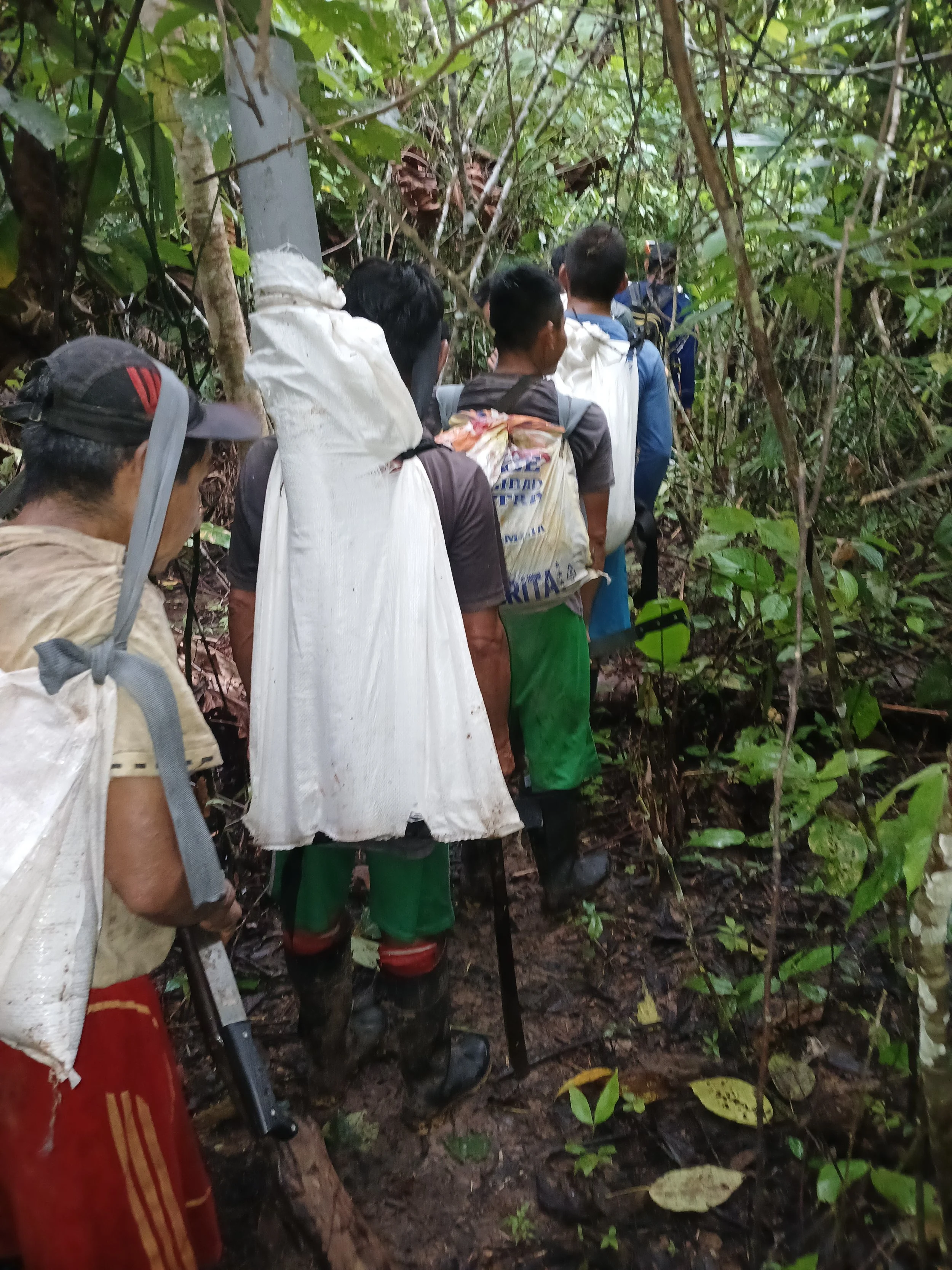
The work included verifying coordinates registered with Peru’s National Superintendency of Public Registries (SUNARP), taking field measurements, assessing the condition of each marker, and creating a photographic record.
“For us, something we had been seeking for the last two years has finally become reality: the correction of our boundary markers”
The fieldwork confirmed in the field the location of boundary markers near an illegal road network, reinforcing efforts to protect communal territory.
A Territory Too Large and Remote to Monitor
Saweto encompasses 78,129 hectares, and its size and remoteness make regular vigilance and monitoring patrols a major challenge for the community.

Location of the Alto Tamaya–Saweto Native Community on the Peru–Brazil border.
Before the intervention, the location and condition of several markers had been a source of concern among community members.
“We believed some of the markers had been moved, possibly due to tractors that had crossed the area,” explained Shawiri, referring to invasions by loggers that occurred in previous years.
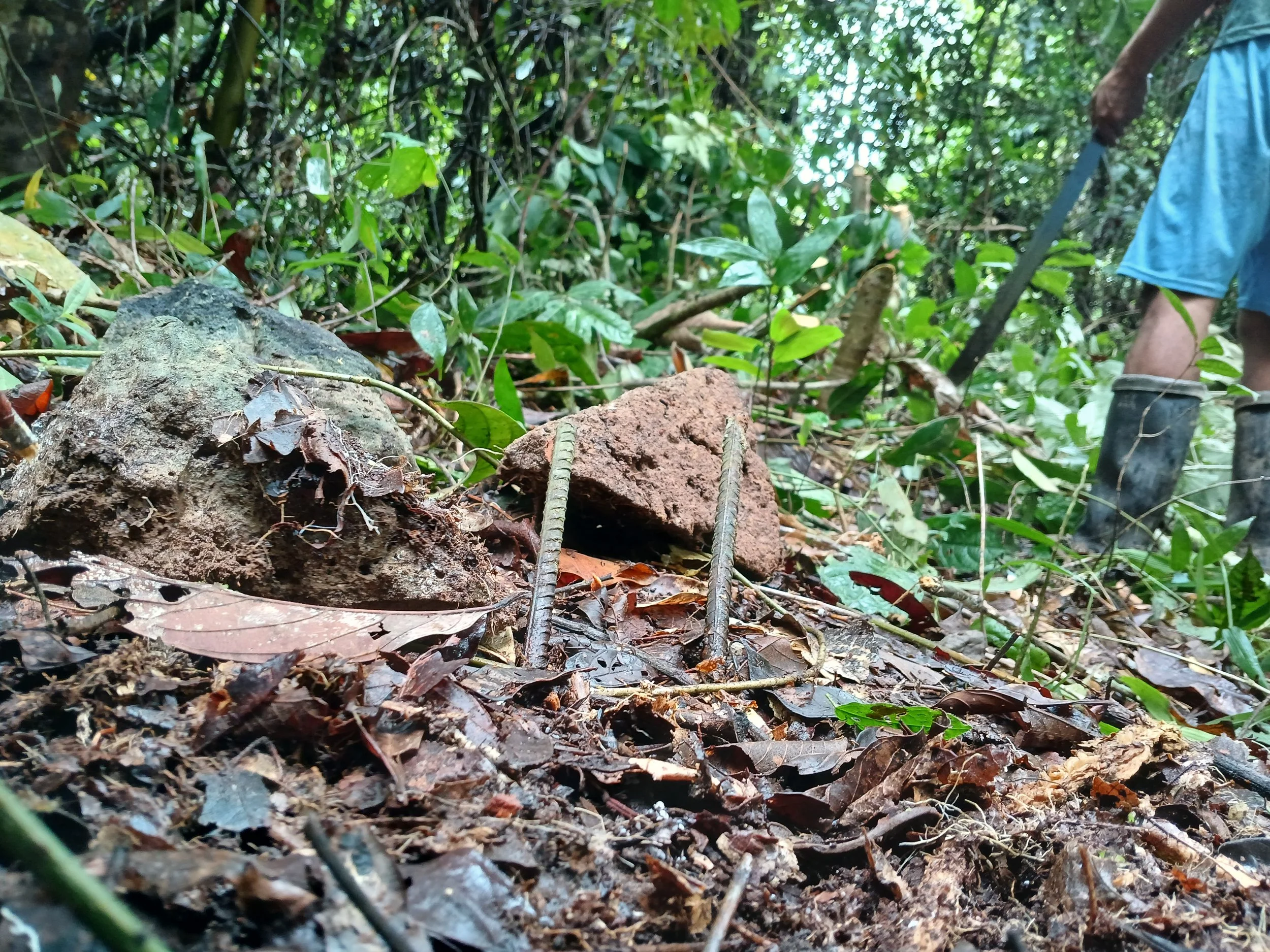
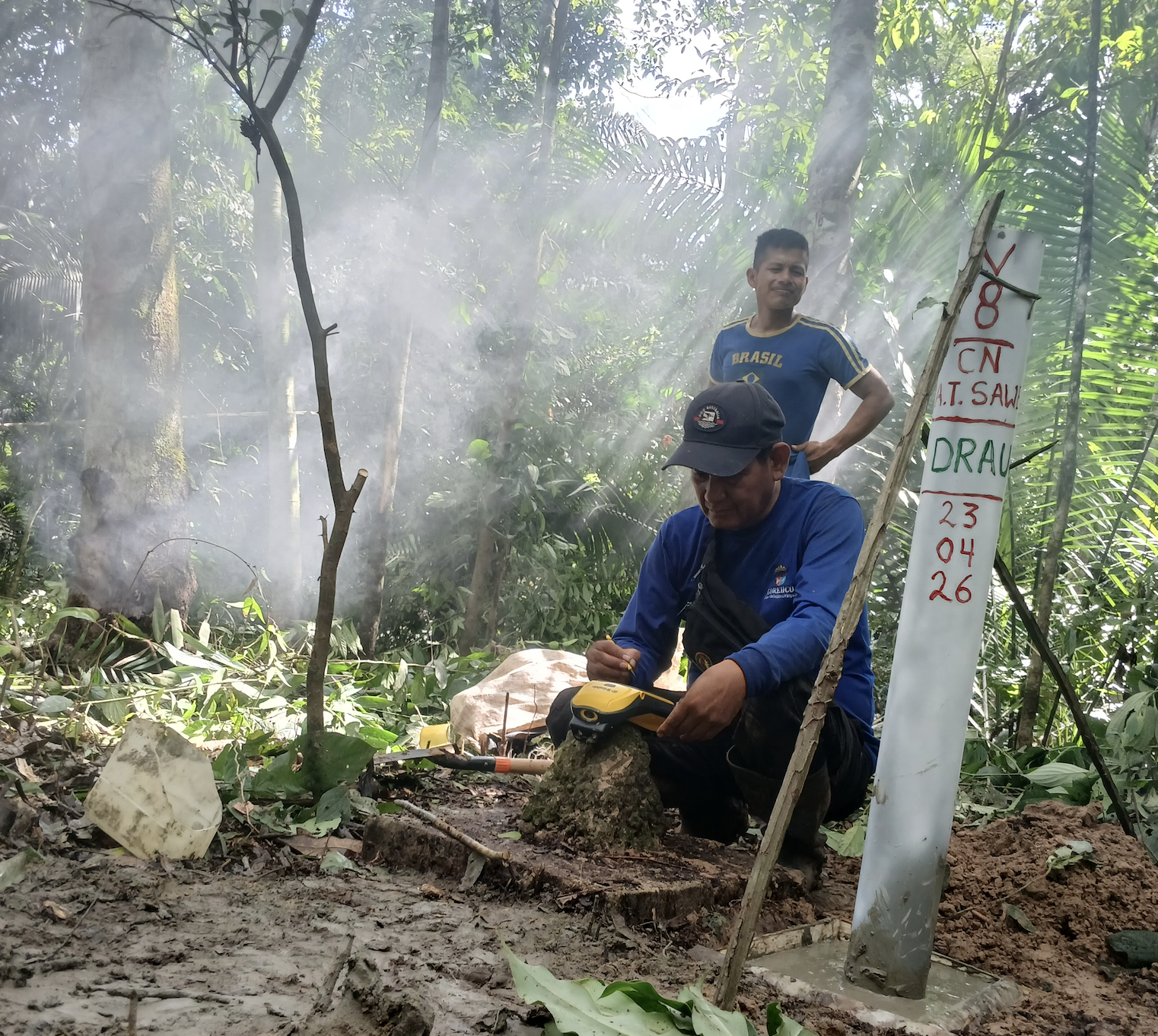
According to the technical report, one of the markers showed discrepancies with its officially registered coordinates and was therefore relocated during the intervention. In addition, two markers were found damaged and were replaced.
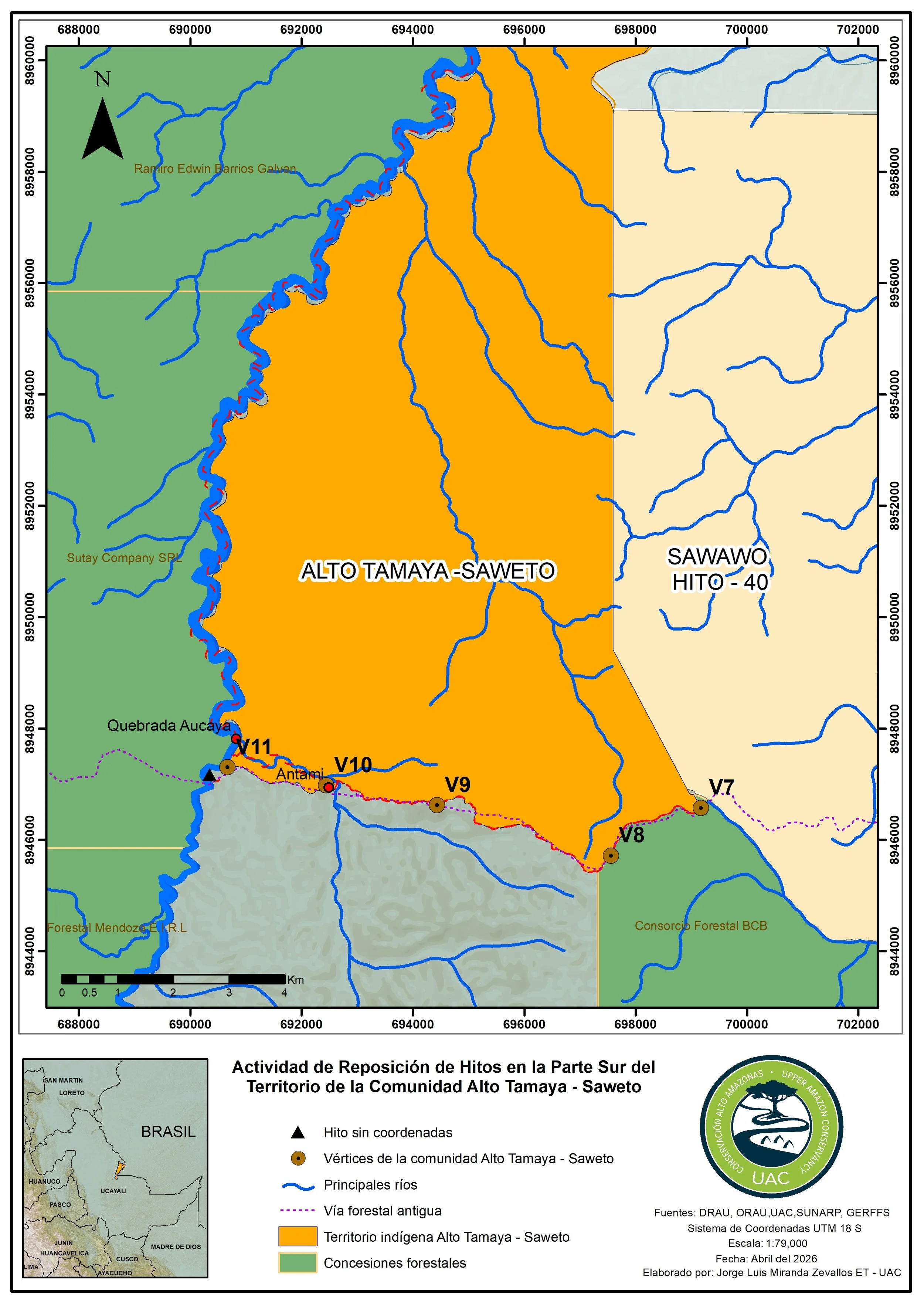
Location of boundary markers 7 through 11, which were reinstalled in the southern area of the Alto Tamaya–Saweto territory on the Peru–Brazil border.
A Key Step for Territorial Security
For the technical team, restoring the markers is a critical action for strengthening territorial security.
“It is a positive action because it helps strengthen the community’s territorial security, especially in the southeastern area bordering the community of Sawawo–Hito 40,” explained Alexander Cartagena, a DRAU technician.
The team noted that the forest remained largely intact throughout the evaluated area. Wildlife observations included capybaras, spider monkeys, macaws, yellow boas, and jaguar tracks — indicators of a healthy ecosystem despite road construction and logging activity in adjacent areas.
However, community leaders emphasized that they still need greater support to protect the territory from outside pressure.
“Due to the lack of adequate support and equipment for our vigilance committee, we are unable to maintain consistent monitoring and territorial control,” said Chief Shawiri.
For Stefania Arévalo Cushamba, president of the community’s vigilance committee, the replacement of boundary markers reinforces recognition of the community’s territory.
“Replacing the markers allows us to recognize our territory and know exactly where it is positioned,” she explained.
Arévalo also distinguished between what was directly observed and what lacked evidence.
“Regarding illegal extraction of copaiba oil, there is evidence of activity last year. But fortunately, there is no evidence of recent hunting of wildlife,” she clarified.
The UC-105 Road and the Future of Saweto
One of the principal risk factors lies in access to the southern sector of the territory. According to technical information collected by UAC in the field, the area contains a road linked to historical logging activity and associated with the UC-105 road network. Although no recent activity was observed during the intervention, the existence of the road increases the territory’s vulnerability to incursions by outside actors.
Across the Amazon, the opening of logging access roads has been associated with increasing deforestation and illegal activities in previously isolated territories, according to data from Global Forest Watch.
Previous UAC investigations have documented the expansion of illegal activities — including deforestation, illegal mining, and road construction — associated with the UC-105 road network.
The verification and replacement of these five boundary markers confirms the accurate location and marking of Saweto’s territory, while also highlighting a more complex reality: protecting Indigenous lands depends not only on legally recognized boundaries, but also on maintaining long-term community capacity for vigilance, monitoring, and territorial control.